
NMMR leads the way to expand Mine Map collection to identifying safety risks on split-estate lands with historic underground mining and current surface development. The digital maps will also support research and planning related to bat habitat, abandoned mine reclamation, data accuracy, and critical mineral resources.
The National Mine Map Repository (NMMR) is spearheading efforts to digitize and preserve thousands of historic mine maps across the United States, playing a crucial role in public safety, environmental protection, and land use planning—especially on split-estate lands where underground mineral rights are separate from surface ownership. As part of a new initiative, NMMR is digitizing approximately 375 maps of federal solid mineral leasing sites. Once complete, these maps will be publicly accessible and made available to the Bureau of Land Management’s (BLM) Abandoned Mine and Site Cleanup Module, as well as other federal and state agencies.
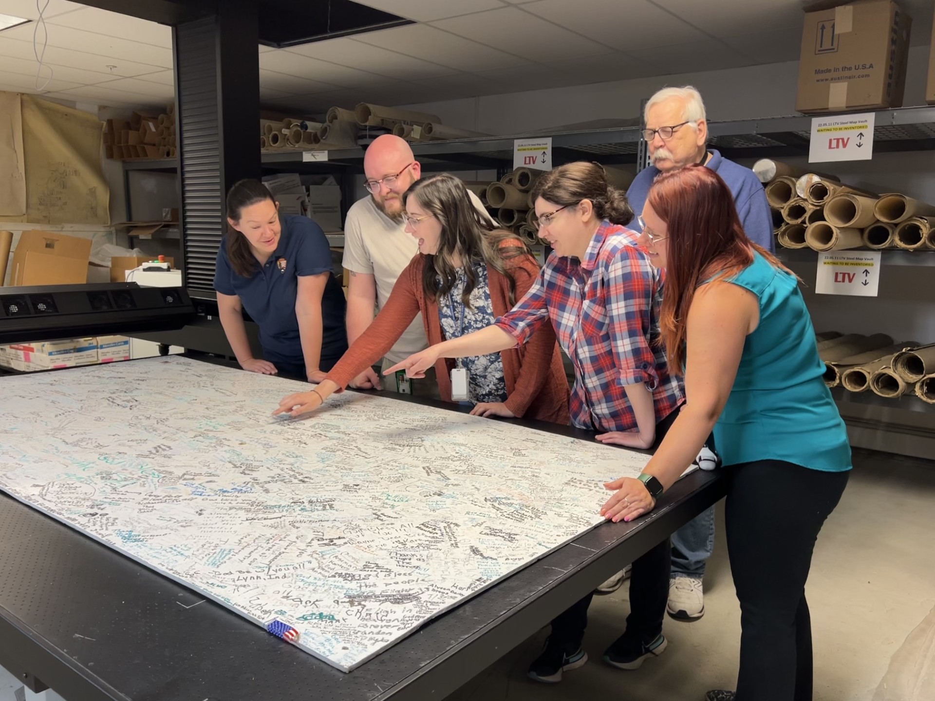
NMMR staff members Harrison Kinzler, Chelsea Solotky, Beth Spindler, Jessica Reitz and retired employee Paul Coyle, along with Western Pennsylvania parks curator Elizabeth Keene, view signed Flight 93 boards being scanned by NMMR.
“This effort is especially important for identifying safety risks on lands with historic underground mining and modern surface development,” said Dorothy “Dot” Van Oss, Program Lead for Mineral Materials and Non-Energy Leasables at the BLM’s Montana/Dakotas State Office. “ The resulting digital archive will be an invaluable resource.” In addition to enhancing mine safety awareness, the digitized maps will also aid research and planning related to bat habitat conservation, abandoned mine reclamation, data accuracy, and the location of critical mineral resources. Many of the physical maps now being preserved were slated for destruction under the BLM records schedule and had never been digitized. By partnering with NMMR, the BLM ensures that this information is not lost but made useful for a wide array of public and scientific applications.
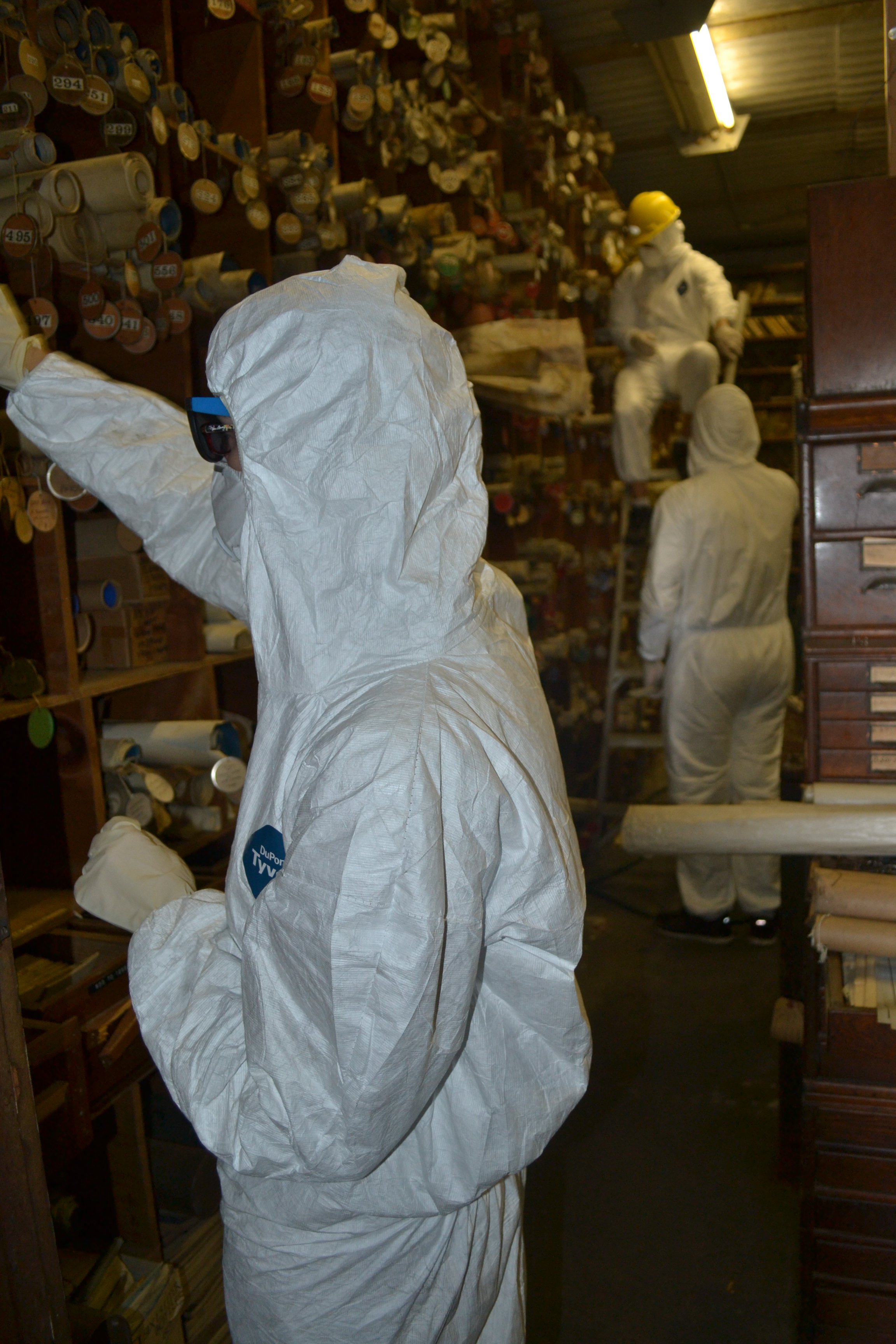
Chelsea Solotky wears hazmat gear during the retrieval of maps from the LCN vault in Coaldale, Pa.
The NMMR, operates under the U.S. Department of the Interior, and has long supported emergency response, engineering, and environmental projects by providing accurate mine mapping data. The repository regularly supplies maps to engineering firms, environmental agencies, and has even assisted during disaster response efforts. “Our mission relies heavily on the generosity of donors,” said Jessica Reitz, Archives Specialist at NMMR. “Whether maps come from private collectors, universities, libraries, or other government agencies, we are grateful for their contributions. These historic documents help protect communities and preserve important data for generations to come.”
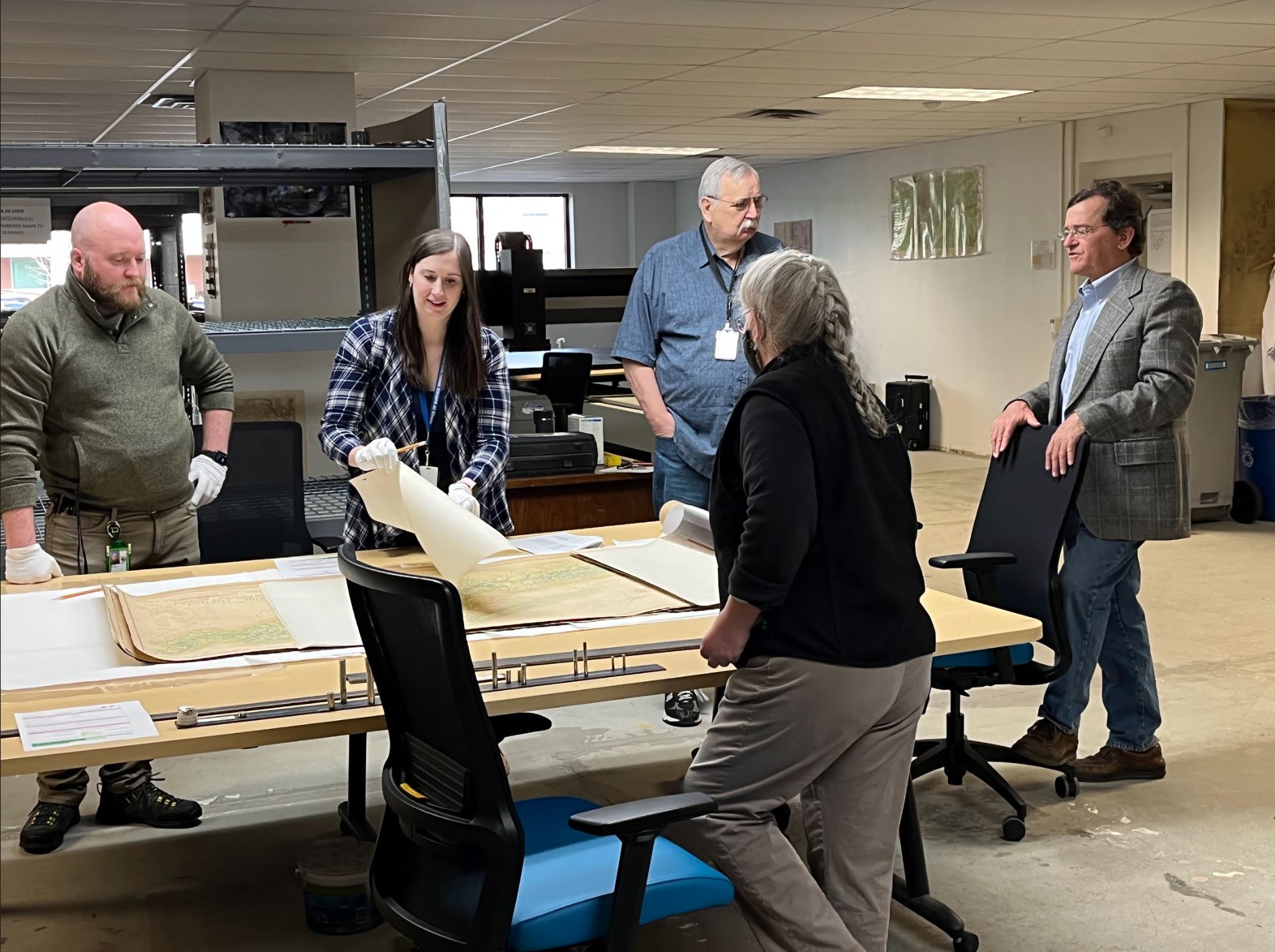
Chelsea Solotky, Harrison Kinzler and retired employee Paul Coyle meet with curators from Shenandoah National Park.
Donors include institutions such as the West Virginia Library Commission, multiple Mine Safety and Health Administration (MSHA) offices, and the Bureau of Land Management offices across the western United States. In addition to building its own archive, NMMR also assists partner agencies in preserving their map collections. Recent collaborations include digitization work for Shenandoah National Park and the National Parks of Western Pennsylvania. All maps received by NMMR are inventoried, scanned, and cataloged in its online public database, making the information readily accessible to researchers, landowners, and government officials. The National Mine Map Repository can be accessed online at: National Mine Map Repository