
Reclaim Restore & More
A podcast dedicated to digging deeper into the Office of Surface Mining Reclamation and Enforcement highlighting stories of the people who work here, and the reclamation projects throughout the states and tribes.
Follow OSMRE on Spotify Follow OSMRE on YouTube
Show Notes:
All rights reserved/Photo by Ben Siegel
In this episode of Reclaim, Restore & More, we tell the story of the Truetown discharge in Athens County, Ohio and how innovative teamwork has turned its acid mine drainage into a work of art. A small-scale effort to gather iron sludge is now a national partnership with the paint company Gamblin that sells three colors of oil paints made with Truetown pigments.
Emily:
An engineering professor, an art professor, a non-profit, and state and federal agents walk up to a creek…it sounds like the setup to a bad joke. But this unusual combination of partners has been the key to a unique project that has garnered lots of attention in the past few years.
Welcome to Reclaim, Restore & More, a podcast dedicated to digging deeper into the Office of Surface Mining Reclamation and Enforcement. I’m Emily Isaac, with OSMRE’s Office of Communications. The following interviews were originally recorded in February of two thousand twenty-four.
You may know Ohio for its Buckeyes and Cincinnati Chili, but it is also known for its production of coal. More than 3.7 billion tons of coal have been mined over the past two centuries in Ohio—that's enough to cover the entire city of Cincinnati with a pile of coal more than 20 feet high. Before federal regulations on coal mining were established in 1977 with the Surface Mining Control and Reclamation Act, or SMCRA, many mines were left abandoned or not properly reclaimed. This can cause a whole host of environmental and human health issues.
One of these lingering effects is an opening, known as the Truetown discharge, that pours polluted water into the Sunday Creek watershed. The Truetown discharge is located in Athens County, Ohio in the bituminous coal region. The source is an abandoned underground coal mine known as AS-193. Kaabe Shaw, an abandoned mine land project manager with the Ohio Department of Natural Resources, provides context about what exactly happened there.
Kaabe:
“It was abandoned in 1963 and all was well with the world. But in 1983, the pump hole that they used to use as a pump hole, but they sealed it in 1963, it ruptured, and it came out in the back of these people's yard, and it was directly tied to an historic abandoned mine land. So we were able to address it because it was water impact from a historic mine, even though it popped out after SMCRA. So at the time, OSM and us did a project and just channelized the discharge to the creek and it sat and here we are, what is it, 40 years later with the knowledge and the funding to be able to address it. So that's how mine drainage in some instances is, It's a long game.”
Emily:
Truetown is the largest single discharge in the state of Ohio, with a flow rate of about 1,000 gallons per minute—that’s approximately 20 bathtubs worth. Each year, it dumps more than 2 million pounds of iron oxide into Sunday creek, which then flows into the hocking river. To put that into perspective, a male African elephant can get up to 14 or 15,000 pounds. That means about one elephants-worth of pollution is produced every two days, or 180 elephants every year, since the 1970s.
John Sabraw, an art professor from Ohio University, tells of his experience seeing the Truetown pollution for the first time.

the first batch of Gamblin Artists Colors paint. © 2018 Ohio University. All Rights Reserved/ Photo by Ben Siegel
John:
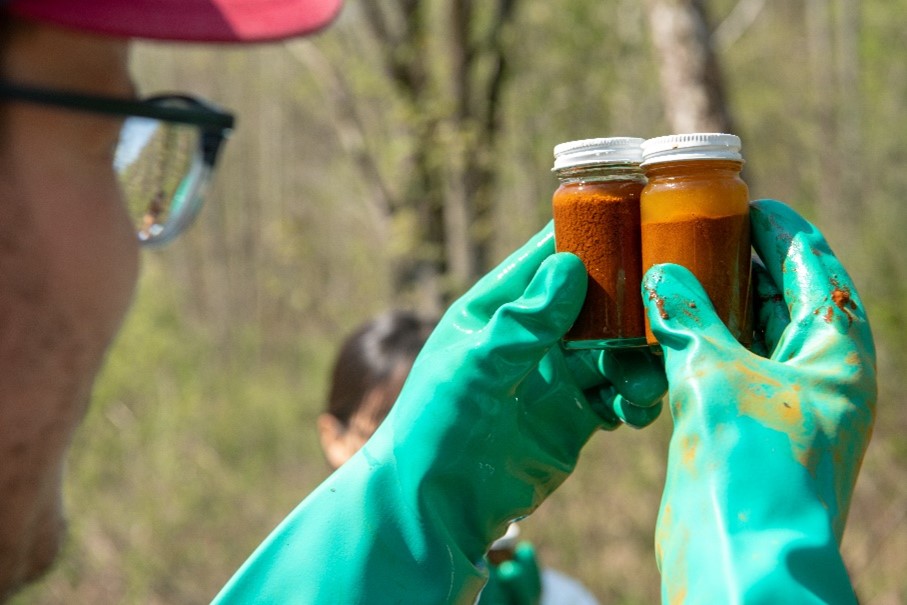
You come around, and you can smell it first. A lot of times, say, about half the time, depending on the size of the seep, you don't even see it and you can smell it. You can smell that sulfur, right? And then when you come up on it and it is this really bright orange and sometimes a little bit deeper red with, if there's aluminum, other things, you got these white edges, it's really, really surprising, yeah.
Emily:
This type of water pollution, known as acid mine drainage (AMD), lowers the pH of the stream to a level native wildlife cannot thrive in. More importantly, iron oxide coats the bottom of the creek bed so that bugs have nowhere to live, and fish cannot lay their eggs. In 1997, an Ohio EPA report found that 13 miles of Sunday Creek were essentially dead.
Sabraw saw the iron oxide sludge and was immediately intrigued by the idea of turning it into paint.
At the same time, Guy Riefler, a civil engineering professor from Ohio University, looked at the Truetown discharge and noticed that the water was trying to clean itself as it emerges to the surface, and that process was being carried out by biological organisms. These organisms live in extreme conditions where other forms of life cannot survive. He thought, if we could just harness the power of these organisms, it could be used to treat acid mine drainage naturally and quickly.
Serendipitously, Dr. Riefler and Professor Sabraw came together and started to make something amazing. Turning pollution into pigment wasn’t unheard of-- Dr. Riefler explains how the inspiration came about.
Guy:
I was at a conference and a researcher from Pennsylvania, Bob Hedin, gave a presentation where he was collecting acid mine drainage pollution and making paint out of it. And coincidentally to that conference that I was at shortly before then, I was also at an advisory committee meeting for Sunday Creek, and they were looking for a solution to their problem and we couldn't come up with anything because it was so big and there was so much iron and there was so much acid and the site was so small and there were all these problems with current technologies. And I saw those two things and I put them together and I was like, oh my God, this is this is my project. Like, this is what I've been waiting for.
So early on when I was working with John, we were looking at different ways of drying the pigment. And what we'd found is I was trying to make goethite, which is a yellow, a specific mineral that's yellow in color. And it's got a strong market value. So I was always targeting goethite as our product. And to do that we found that you needed to dry it at room temperature because when you heated it up, the color changed. And John was over my lab and he's he said, well, how high have you tried? Well, I haven’t because it gets it gets browner as you get hotter. And he's like, well, let's try hotter. I said, why? And he said, well, let's just try it. And so I processed some of the pigment and put it in an oven that I have. And it turns out when you heat it up to 500 degrees Celsius, it turns this brilliant red color, like it is an abrupt change in quality. And it's a gorgeous color and actually, it turns out it's a different mineral. And so we got those results, and it was amazing, and it makes a great pigment. And John came back and he said, so how high does that oven go? I said well, it goes all the way up to 2000, but we don't want to do that. And he's just let's do it. So we processed it at 2000 and it turned into this amazing purple, which apparently in the art world is very unusual to have an iron based purple pigment. It's hard to get a good color purple. There's different natural sources from it, but there aren't really many iron-based ones. And we still haven't figured out exactly why it's purple, it’s something I'm still scratching my head about. So just a good example of how having a creative, fearless person around can drive the research.
Emily:
Sabraw and Riefler connected with a local non-profit called Rural Action and started a small-scale effort to gather iron sludge coming out of the Truetown discharge and turn it into pigments. They started a partnership with the paint company Gamblin, which now sells three colors of oil paints made with Truetown pigments. There’s a large market for iron oxides in the U.S., yet almost 90% of what we use is imported. This means that there is an opportunity to meet that demand with a sustainable, domestically sourced product. Brent Means, a hydrologist with the Office of Surface Mining Reclamation and Enforcement, explains how we can start looking at pollution as an asset.
at the Truetown site. Photo courtesy of Kaabe Shaw.
Brent:
You know, one viewpoint is that it's all this pollution that's coming to pollute the environment which that's true, but the other truth is also you know humans mined, created this void which allowed pyrite to oxidize produce iron and now Mother Earth, through precipitation events and flooding the mine and then that discharging, is somewhat mining the earth for iron. So you can also look at this as instead of basically ripping up, you know, like they do for iron up in northern Michigan or the iron belt is to mine iron ore, we're letting Mother Earth, we'll say right now, dissolve the iron minerals into the mine drainage and then you can look at that as a feedstock to recover the mine drainage or recover the iron that could be used in a commodity. So the other way of looking at this is not just that it's pollution, but it's a potential resource.
Emily:
This is where things started to ramp up, and the team realized they needed to think bigger if they wanted to start a commercially viable operation while treating the pollution at the same time. They received a $1 million Abandoned Mine Land Economic Revitalization (AMLER) grant, an OSMRE program that supports local investment opportunities that provide for sustainable long-term rehabilitation of coalfield economies. Kaabe Shaw explains how ODNR and OSMRE helped develop a pilot plant to test their methods.
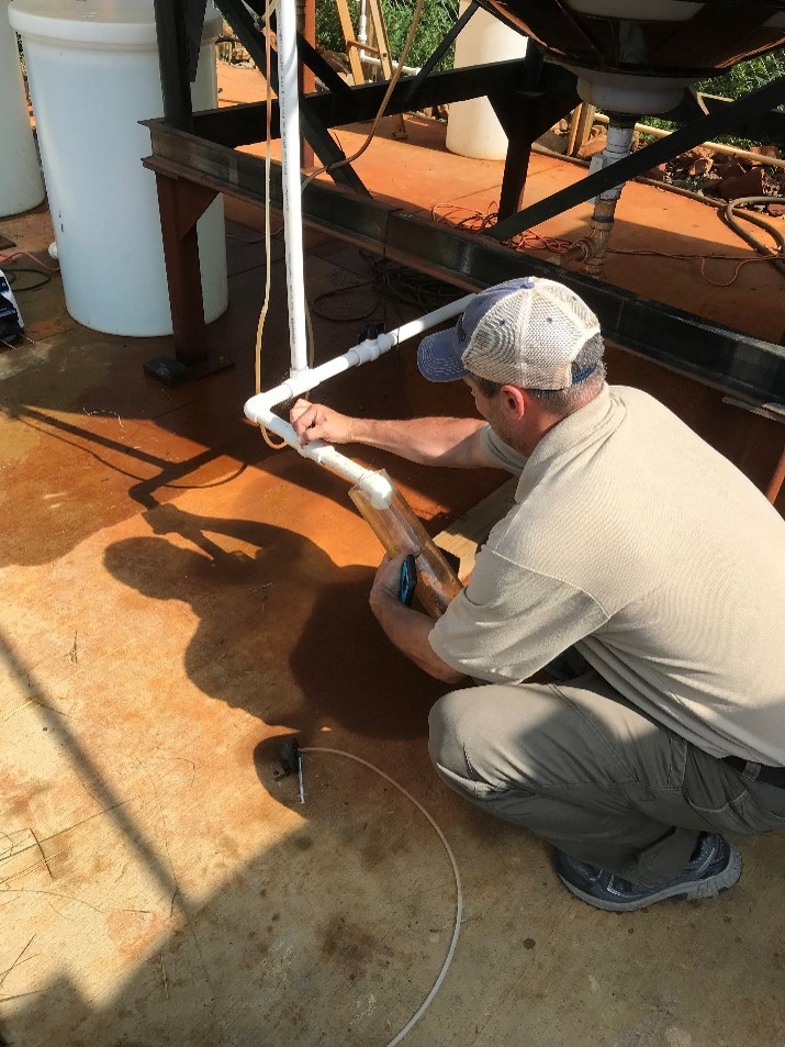
Kaabe:
We started out with kind of an idea from Dr. Riefler the engineering professor, and OSM brought a team down. We set up a pilot plant onsite right next to the seep and OSM came in and did a two- or three-day test out there at the pilot plant. We kind of had to reorganize and change our treatment strategy. So they've been pivotal in actually nailing down the appropriate treatment strategy for the water chemistry and flow that's coming out. And then getting it to this point where we found the consultant and now when the consultant submits design, design flows, plans a lot of that, since Rich and Brent have the experience, we’re leaning heavily on their technical expertise. It's beyond what the other... the other members have their expertise as well, but quality control and quality assurance. And even that consultant was impressed with our level of review because they said a lot of times they’ll submit documents and nobody reviews it, and they were really happy to have all the feedback that our team provides, led by Brent and Rich. They're just very easy to work with. I really, if they weren't involved, we would not be where we are right now. And I tell them this all the time, but it's the truth.
Emily:
Brent Means and Richard Beam from OSMRE’s Pittsburgh Field Office are providing technical support and expertise on designing a large-scale treatment system and assisted with water quality testing at the site, while ODNR directly oversees the design and construction process. Through pilot testing, the team realized they needed to adjust their initial idea, as it is tricky to treat such a massive amount of water while also harvesting the iron oxides in a way that is suitable for high-quality pigment. They developed an innovative method using a chemical oxidant to target the iron and force it to precipitate quickly. However, there will be a section of the treatment plant where Dr. Riefler and his students can continue their research on his biological treatment method.
Guy:
I've had probably 10 to 15 graduate students work on this project and probably the same number of undergraduate researchers and then several classes. We've used it as a as a class project. So, you know, a lot of my students are interested in cleaning up pollution and same thing I'm interested in. And making the world a better place, and we talk about these methods in class, but it's not until you really get out and get your sneakers all orange that you realize, that you make the connection between the class work, and you know, your own community. Because these sites are pretty common out here in southeast Ohio. And every community has got its own set of problems. This is the one that we have. And it's easy for the students to see the importance of what they're learning and see the impact that they can have. And they find it really inspiring. And I've seen the difference. I've seen their attention to class work change once they've been out and working on something like this. So, yeah, it's been a great experience for me as an educator.
Emily:
Rural Action has also been granted $3.5 million from the Infrastructure Investment and Jobs Act to build a 39-acre treatment facility, which will treat approximately 1.4 million gallons of water per day. In addition to the treatment plant, there will be a wetland onsite to filter out any remaining metals. Normally, since treatment systems are not very visually appealing, efforts are made to obscure them from view. This time, however, the team started thinking about the possibility of highlighting the treatment process, rather than hiding it.
Brent:
And the art professor's like, well, you know, if we have a wetland, I mean, of course I'm just thinking a square rectangular wetland like all the ones I've worked on in the past, and he's like, well, why can't we make it like a leaf shape and, you know, have different colors here and there, and then we can have a community path and, you know, an interpretive trail. And so, yeah, I mean, I'll just say that, you know, working with people with different interests, I mean, literally there's an energy there that makes for a way better project because, yes, you can shape the wetland in any way and why have a rectangle if you can have something more visually appealing that would maybe attract the community over to say what's going on here. And in the meantime, they learn something about the environment and support future cleanup efforts as well.
Emily:
During their collaboration, John Sabraw gained insight into the benefits of bringing art and science together.
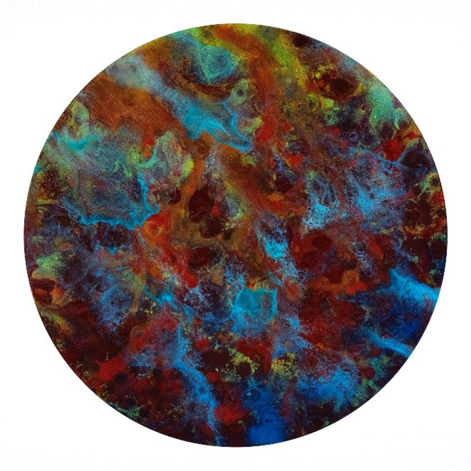
pigments oil paints, with a gold overlay of a
coal mine map in the top left. The piece now
resides in the Department of the Interior’s
museum in Washington, DC.
John:
I mean I enjoy my role, as you know, I don't know, as a fool to the king or Joker to the king or whatever. It's my job to come in when the engineers are talking, It's my job to go like, well, yeah, but what if everything was a banana, you know? Or you know when we're designing, you know, we had to figure out the wetland. And I was like, well, what if it's a community wetland? And what if it's actually a sculpture park and they flood with the seasons and everything and everybody gets really, really quiet in the room and I know I've overstepped, you know, normalcy. But then they’re such cool people that after that quiet, they're like, I don't know, maybe? And I'm like, what about this? Is it gonna look like this? And it could look like this and we could do this, and then eventually we're now literally designing this wetland as a sculpture park and it's kind of, that's my job. And I'm OK with it.
John:
Art and science share two things. Curiosity and failure. Scientists are absolutely a curious bunch, which is why it's really, really fun to hang out with them. You know, they’re maybe the profession that's most closely related to artists in terms of the fact that they just don't stop wondering about things and asking questions about things. And that's all we're doing as artists. That's all we're doing. Like what if this was this? And what if I could make a thing that looked like this? And what if people could come and see that and have a conversation I want, right. And so that's amazing. But the other thing is that and this is something I learned working with my colleagues, is that like you know, boy, there's a lot of failure in science. There's just a lot of failure. You're like, yeah... Oh dang, no. And in arts, the same thing. You’re like this is gonna be the most amazing—oh, maybe it's going in the dumpster, and you know, there's this sense of failure, but together I think it's just a part of our psyche that, you know, it doesn't stop us. It rarely even slows us down. We're like, OK, what's next? And I think that's something that artists and scientists share for sure.
Emily:
The treatment project will not only benefit the environment, but the surrounding communities as well. Low-income communities are disproportionately affected by polluting industries and are not often prioritized when it comes to development. The hope is to invest in these areas that have historically been left behind.
Brent:
Communities for like 100 years have just know nothing but red water and dead streams. And overnight they're like confounded. Like you know, what the heck happened last night? The stream is clear! They may have no idea five miles up the stream an AML program is developing this mine drainage treatment plant that literally will change the stream overnight, at least visually. Biologically, it may take months or years, but visually, it's overnight. And that is a crazy magic trick that, you know, is going to be experienced at Truetown and it's pretty exciting. So yeah, the socioeconomic effect, you don't need data to prove it. You just you just need eyes to look out there and say, would you want to live next to this? Of course not.
©2018 Ohio University. All rights reserved/ Photo by Ben Siegel
John:
The truth is, if you meet people one on one, 90% - 95% of the time people are just people. And their political views are different, etcetera, but on the ground, you meet people, you want to get something done, you explain what it is; 95% of the time, they're like, let's do it. No matter who you are, no matter where you come from, they don't care, right?
Once you describe what you're doing, gosh, you just kind of almost instantly made a lifelong friend […] I'm not gonna speak to like, how they view acid mine drainage in general, but people I spoke to know that they remember catching fish out of the stream. They remember playing in the stream without getting all their clothes orange and things. So for them, I think in terms of their own psychogeography, what I've heard is that they understand what this means, and they're really on board with it. And I'd like to deliver for them, you know.
Emily:
Michelle Shively MacIver, Rural Action and True Pigments, LLC’s director of project management, has played a pivotal role in fostering community relations and making sure their voices are heard.
Michelle:
“I remember really early on seeing a landowner out at a festival in Shawnee and she like, came straight for my table. I had big, you know, pictures and a big tabling setup, and she came up and she said, what did you guys do? And I thought, oh my gosh, what did we do? I don't know. And she said no, there are fish in the West Branch. There's fish by my house. Like what? What did you do? And it was right after we had installed the dozer upstream and she was seeing the impacts of that. And her family had lived there for generations. And she had in her lifetime never seen fish in that part of the creek. So those kinds of stories are the most rewarding and I think really at the heart of why we're all doing this kind of work.”
“We have this one site in particular that’s downstream of one of our lime dozers in a small tributary called Pine Run. And we had actually stopped monitoring, doing fish and bug monitoring. Downstream of that, we have a site near a high school in in Perry County, southern Perry, and we just stopped monitoring there because it had been years and we literally had not caught any fish, it was essentially dead. And just a couple years after we installed the dozer, we were able to find 17 species of native fish at that same site. So to go and from zero fish to 17 different species is pretty incredible. And now I'd have to look, but I think we're up to like 21 or 22 species at that site and have, you know, kind of marked some other metrics of the number, the quantity of fish that we find and you know, just seeing really incredible recovery in that stretch of stream. So we know what's possible in Sunday Creek and we also know that there's a lot of recovery potential following this True Pigments project at Truetown because we have this great, you know, water quality that's further upstream in the watershed and also the Truetown discharge impacts the bottom 7 miles of Sunday Creek. So then you've got the confluence with the Hocking River, which is also a higher quality river. So, you know, we're kind of like, bookended by good fish populations. So when we fix that water quality in between? I really feel like we're going to see that recovery happen pretty quickly.”
Emily:
A groundbreaking ceremony was held in June of 2023, and the Truetown project is currently in the design phase, which will take a year or so to finish. After that, construction will take another two years. The plant is projected to open sometime around 2027.
This project has started a lot of conversations about other beneficial uses for pollutants like iron oxide, and how lessons learned from this process could be replicated and applied to other efforts in the future. Dr. Riefler explains how even small treatment projects could benefit.
Guy:
At other sites where the iron concentrations are lower, it would be hard to make it profitable to do the same thing. You know, you still have a lot of water to treat, but you're producing less pigment to sell. So there's a limitation there. But one way we've envisioned this is that, you know, once the Truetown plant is up and running, we could truck sludge from other plants to the Truetown plant. So the Truetown plant could be sort of like a hub for pigment production, while we can use the same technology at other sites to clean up the water without having to build multiple pigment operations. So that's one model which we're considering.
Emily:
Rich Beam, an Abandoned Mine Land and Regulatory Program Specialist with OSMRE, expands on other beneficial ways mine wastewater can be used going forward.
Rich:
For a number of years in Pennsylvania, the gas industry has been opting to use treated mine water for hydraulic fracturing of gas wells and the shale gas wells in the Marcellus and Utica formation. And it's a pretty impressive impact because instead of using clean water sources like stream water or municipal water, in some cases being able to use treated mine water for that purpose really is a multifold benefit.
Also, back in the early 2000s, 2002, Pennsylvania DEP partnered with a watershed group in northwestern Pennsylvania called the Toby Creek Watershed Association. An active mine drainage treatment plant was built onto B Creek on a discharge of about a 500 gallon a minute abandoned underground mine discharge. Water is treated, it improves Toby Creek, but the other really cool thing about it is Toby Creek Watershed Association uses that treated water to raise fingerling trout. And every year they have trout that they stock all over western P.A. And the income from the from the trout hatchery portion of the treatment facility does offset some of the cost of operating the facility.
I've also going to say more recently there's been a lot of interest, especially in the state of West Virginia, for looking at, and actually more than just looking at, there are pilot projects, And I think they're well on their way to developing full scale projects, looking at extracting rare earth elements from my drainage or from the treated mine drainage sludges.
Emily:
All in all, the Truetown project is the result of the symbiosis between different entities coming together to revitalize coal communities and the environment. ODNR works tirelessly to reclaim abandoned mine lands across the state with federal funding from OSMRE— In 2022, ODNR estimated that exposure to dangerous AML-related issues was reduced for 23,888 people due to their reclamation efforts. However, the fight is far from over—more than 67,000 acres affected by abandoned mine lands in Ohio remain in need of clean-up.
Luckily, the Infrastructure Investment and Jobs Act has boosted support for Ohio AML work to the tune of $46 million annually. Federal resources, state agency efforts, and on-the-groundwork from Rural Action, plus a little creativity and ingenuity from two unlikely partners from Ohio University, has turned out to be a recipe for success.
John:
The solutions to climate justice? The solutions to all these things that we're dealing with, whether it's the energy infrastructure, whatever you want to name it. We can solve it right now. Not because there's a miracle vending machine, but because of exactly what our project does. Bringing creative communities and scientists together with government support, you can get it done.
Emily:
You can keep up with Rural Action’s effort to produce pigments at www.truepigments.com. You can also follow the project’s progress at www.odnr.gov, under their mining reclamation and restoration page. For more information about OSMRE’s efforts to restore and revitalize former coal mine lands and communities, visit www.osmre.gov.
Thank you for joining us on Reclaim, Restore & More— stay tuned for what we dig up next time! From OSMRE, I’m Emily Isaac.
Sources:
https://epa.ohio.gov/static/Portals/35/nps/WAPs/SundayCr.pdf
https://ohiodnr.gov/static/documents/geology/EL8_Crowell_2008.pdf
Show Notes:
Wake Forest, Virginia
In this episode of Reclaim Restore & More, we speak with members of the National Mine Map Repository (NMMR), a program area within OSMRE charged with maintaining an archive of mine maps for mines throughout the United States. Their expertise led to an investigation of historical accounts. The findings set the stage for an exciting commentary on life at the intersection of American history and coal mining in Wake Forest, Virginia. Esther Jones, a cornerstone in the community, contributes firsthand recollections, recorded by Tyler Bergeron on behalf of Virginia Tech, that enable us to make a connection between this series of mine maps from the state of Virginia and the history of Wake Forest.
Esther (VT INTERVIEW)
Well, my whole family was involved in the mines. My father was a (miner) – you know he worked in the mines. But in the later years, when my husband came along, we, you know, had the mines in the mountain. It was more or less – a family affair. And it was hard…hard work too – you know, working in the mines.
Raphael
The voice you just heard was Esther Jones and was recorded by Virginia Tech. Esther was born in the year 1920 just shy of 60 years after the emancipation proclamation and 2 years after the first World War. She lived through World War II when the United States nearly doubled neighboring powers in coal output and the civil rights era when segregation and integration were points of contention.
Her unique experiences and recollections lead us to investigate the lives lived therein at the intersection of American history and industrial coal mining. The existence of this record of Ester’s life at Virginia Tech gave the National Mine Map Repository important information that enabled it to make a connection between a series of mine maps from the state of Virginia and the history of Wake Forest.
The contents of this podcast are for informational purposes only and should not be interpreted as an endorsement of any product, service, or enterprise.
I'm your host Raphael Evans and today we’ll be speaking with members of the national mine map repository. An organization within OSMRE that is charged with maintaining an archive all closed and abandoned mine maps throughout the United States. The NMMR assists both private and public sectors in evaluation of map related data for economic valuation, risk assessment, industrial and commercial development, highway construction, and the preservation of public health, safety, and welfare.
Essentially, their collection of mine maps is used to identify what’s underfoot so that those with plans to move earth to reclaim or build know where potential issues may occur. Sometimes the NMMR staff work on projects that have limited data making it more challenging to identify the surrounding area and understand what took place on a mine map.
Due to that lack of information these projects end up being called cold cases. Program Specialist Beth Spindler, and two Archive Specialists Jessica Reitz and Chelsea Solotky were working on a particular cold case that had more than just map data involved. And that’s what brings us here to today to discuss a Bright Spot in a Dark History.
So, now that we’ve prefaced the conversation. Beth why don’t you give me a little bit more insight about the lay of the land, and Chelsea I’d like to get you to chime in on why this story was so important and why the National Mine Map Repository didn't give up on this cold case.
Beth
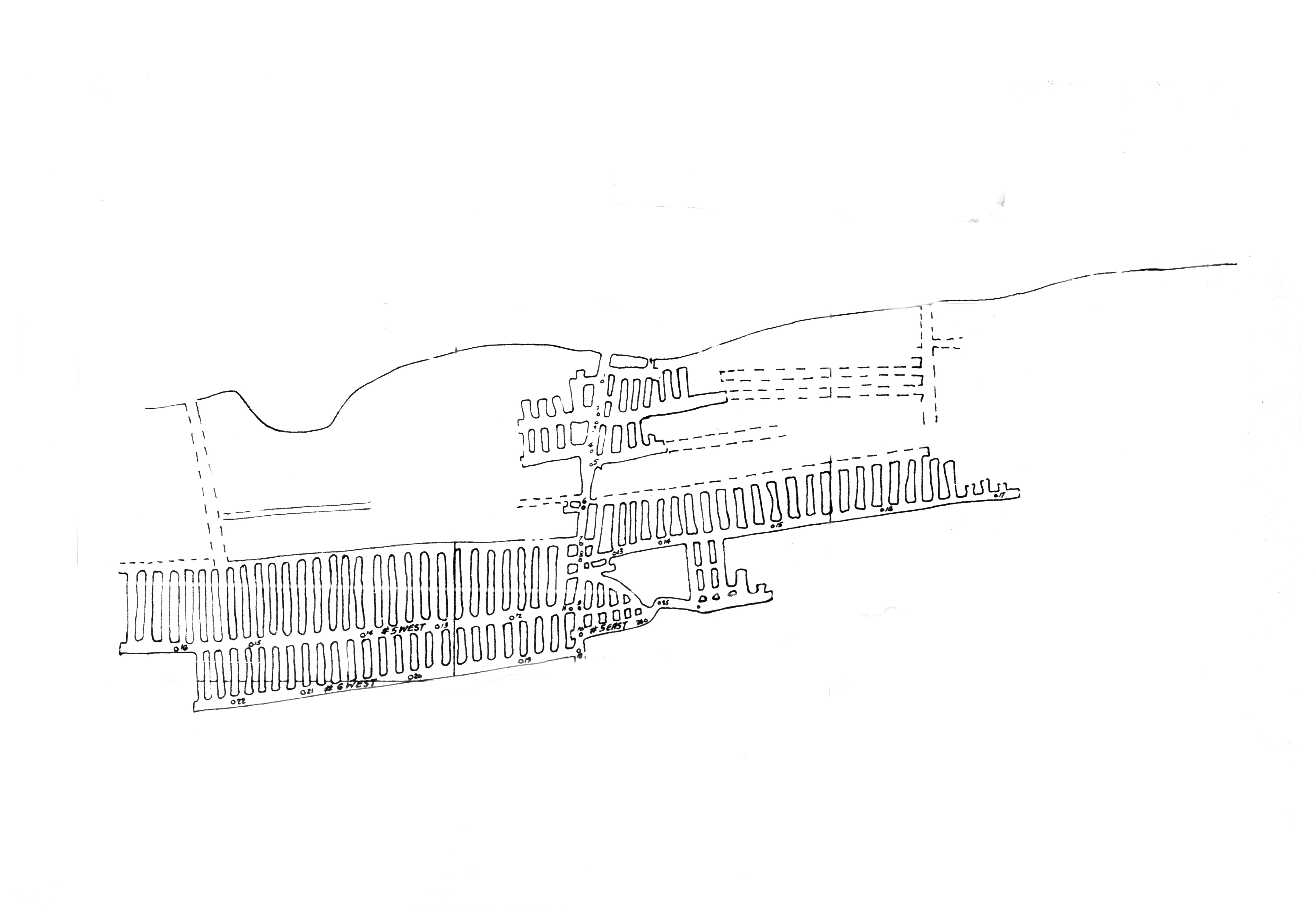
We were working on a project to update, improve, the data for a series of mine maps from the state of Virginia. If you're not familiar with the geology and economic history of Virginia, it has some very major bituminous coal mining fields in the western portion of the state. In the course of doing this project, I came across a map from a portion of the state that at the time I was unfamiliar even had coal mining. This is in what's known as the valley coalfield in Montgomery County which is a bit further east along the New River, and this was a very small coal field of anthracite and semi anthracite coal which is a different form of coal.
Due to its geologic history is actually much harder to locate using the traditional means we use to locate mine maps which is often looking at this stratigraphy and correlating that to the service topography, Chelsea probably can tell you more about this as a geologist, but in anthracite beds the coal seams are often folded or steep the angled and it's not as clear to just look down at the surface to see exactly where the coal mine is. Based on how it looks underground, it may look very different from the surface.
Chelsea
We are in the areas of McCoy, Virginia, Wake Forest, Virginia and Montgomery County, Virginia. So, this area of anthracite, coal vein is about 100 miles east of the typical bituminous coal beds in Virginia. And anthracite is really special, especially to stumble upon it this way because it is more lucrative and a more expensive form of coal than that bituminous coal.

So, what made this map a really interesting coal case was the map itself actually had a lot of decent data on it. So, when we have a cold case where we can't geo-locate or pinpoint that exact mine location. We pass it around the team, we work together. We really try to find it and especially maps where this map had a north arrow; it had Virginia State file index numbers on it. It had a coal, I think a company name, a coal company name; it had an ID of location on it.
So, there was a decent amount of data to be pulled from this map. So, we were definitely not going to give up on this map with the amount of data available. But it was really hard to locate!
Beth
And in the course of trying to desperately find any information about this that I could, I ended up just doing the most basic thing imaginable; for a lot of people this might be their step one, but this is our step #1 million at the mine map. I just googled the name of the mine and to my surprise there was a news article with an interview with Esther Jones who was the wife of the owner of this mine and not just the wife she actually as we came to find out worked at that mine herself and played an important role in its development and maintenance.
Esther (VT INTERVIEW)
I kept the books and kept the payroll, and he had about 21 people that worked there. It was a smaller mine – it wasn’t a bigger mine. And I had to take out the Social Security and you know and also send their payroll up to the people they actually owned it were up in the Baltimore area. I had to make a monthly report, you know, and send it there.
Beth
Without having found that news article, I would never have known anything with special about this mine whatsoever it was just another hole in the ground to me. So, finding her interview is ultimately what gave me the clue to where specifically this mine was located planet earth. For our purposes for making these maps accessible for people that's normally where the story ends. We were able to add some indexing data so that people can find it via geographic or text-based means, and you know – the end. We improved the data, you know, time to move on to another map. Through the course of reading this interview and finding out the history of this mine and that it was an integrated coal mine. That's really where the story opened up for us.
Raphael
Beth, when you mentioned Esther Jones being the wife of the coal mine operator slash owner and also her being involved in a coal mine operating as a black woman for that time period how did this come about where she's married to a coal mine operator and a black family owns a coal mine in that time.
Beth
So, during the civil war era, a huge portion of the land in Montgomery County was owned by a man named James Kent. He also was the largest slave owner in the region according to one oral history during the civil war, after an event known as the battle of Cloyd’s Mountain, union troops stayed on the Kent Estate. I don’t want to use the word trashed the place, but they camped out there and the Kent family fled and returned to find that they had suffered a lot of damages.
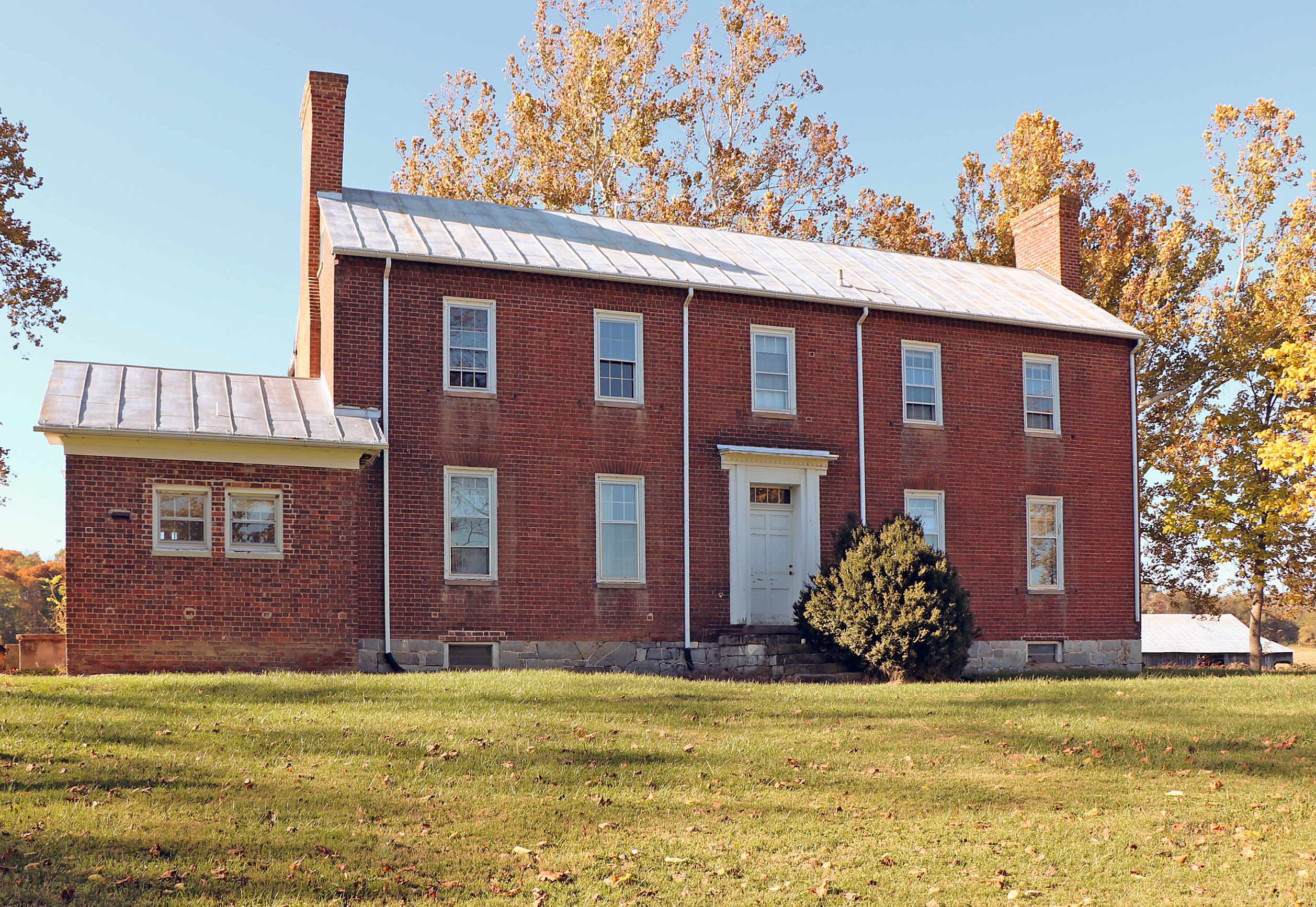
Reportedly this was very emotionally distressing to James Kent, and he left the operations of his estate and his farm to his wife Elizabeth upon her death she left in her will a large portion of land on rush mountain to formerly enslaved peoples who worked on the Kent Estate. This area was later known as Wake Forest and the legend goes that when the peoples moved in there to set up their community the forest was awoken – hence the name Wake Forest.
Esther (VT INTERVIEW)
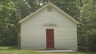
That’s how the name became Wake Forest. They said, “where they have awakened the forest,” you know, when it comes to cutting down the trees, you know, the people building homes and building churches and so forth and all. So, that's what I was told that that's how the name wake forest came about.
Beth
Finding her interview is ultimately what gave me the clue to where specifically this mine is located on planet earth and for our purposes of making these maps accessible for people that's normally where the story ends. We were able to add some indexing data so that people can find it via geographic or text-based means and, you know, the end. We improved the data – you know, time to move on to another map. But, through the course of reading this interview and finding out the history of this mine and that it was an integrated coal mine, that's really where the story opened up for us.
Raphael
I was curious though from your P-O-V, when you explained the lucrative nature of anthracite and what was found in this coal seam. How crazy is it that Elizabeth Kent would donate or willingly part ways with land that could have such a great opportunity for her if they continued mining it, or if they chose to mine it – I guess the mining didn’t happen. Is that just a big happy mistake for those that inherited the land.
Chelsea
Yeah, I think just a lot of things lining up very specifically for this to happen this way in this area.
Through the ambitious endeavors of striving to gain land a lot of recently freed blacks went into debt and then creditors were known to prey on the illiteracy of blacks and poverty so there's a great big socio-economic crisis back in the early 1900’s.
Raphael
So, we’ve talked a lot about the data, Wake Forest and Esther Jones, and in a roundabout way we’ve talked about the mine in question that sent us down this rabbit hole, but I intentionally left out its name to leave room for us to discuss the surrounding details. The Mine seated in the valley coalfield operated by Howard and Esther Jones is called the Jones-Keister Coal Mine. Which prompts the question… why the hyphenation?
Thanks to the NMMR’s research, we know that the mine was co-operated between the Jones family and Warren Keister. Earlier I mentioned that this story incorporated recollections of the lives lived in this area at the intersection of post-slavery and industrial coal mining, and this is the nexus point. Warren Keister’s Grandfather was enlisted in the civil war. So, we have two lineages from very different origins that lead to these two families co-operating the Jones-Kiester Coal Mine. Beth, can you shed some light on the situation.
Beth
His grandfather was a man named Benjamin Keister who mustered into the same regiment that fought at the battle of Cloyd’s Mountain back in the 1860’s. I'm not completely sure his grandfather was there there's a chance he mustered out before actually fighting but it still makes an interesting full circle of events go from fighting to preserve human bondage to working side by side with people who were formerly enslaved, and the best I can understand based on the words from these oral histories and other interviews is that the economic opportunities afforded by coal mining just smoothed over some of those other socioeconomic disparities and smooth over I guess the racial tensions because they're all in it together.
Labor mining and unionization history of the coal mines there apparently played a big role in ensuring that blacks and whites received essentially equal pay and I think anyone who has worked in a highly dangerous industry can tell you that it forms strong bonds of camaraderie your life is in the hands of the person you're working next to and when you're down in the mine and think it makes some of those superficial differences disappear when it doesn't matter the skin color or the ethnic origins or the immigration status or anything else about the person you're working with they just you both want to come out alive at end of the day.
I actually have the quote for you that may be of interest from another black coal miner named Oscar Sherman he gave an interview with The Roanoke Times where he said, “When you got that coal dust on you. You couldn't tell who was black or white.” So, in some ways there was a very literal element of, you know... It didn't matter who was next to you because when you're all just down there in the dark and the dust you're just a human.
Raphael
When it comes to coal mining and its history and black history and how they intersect I think that's an incredibly beautiful way to look at it. That when laboring and toiling over something, some of our natural biases could dissolve and fade away.
Beth
I don't mean to suggest that there was no such thing as racial strife or racial tension it was still an era of desegregation, but I found it very interesting when reading the interviews, the way pay scales worked in the mines back in that day was essentially loaded a cart full of coal and that's how much you get paid per car. So, there’s less room for discrimination there. That doesn't mean there's no room for discrimination.
In another interview with a former black coal miner, he did point out that there were cases where whites got preferential choice over which part of the mines, they would work in, so you know a richer part of the vein the more productive headings. When you drive the tunnels in that's what's known as a heading. Those were often preferentially given to white people so again this didn't eliminate racism.
This didn't eliminate the disparate impacts that race may play in any you know in the workplace, but it certainly provided more opportunities for parity than in other places where you might be getting paid a wage or put into debt peonage with um tenant farming and similar extremely exploitative labor practices.
Raphael
I might be correct in saying that I heard one of Esther’s oral histories where she said, “You know stuff still happened and it didn't dissolve everything,” but Chelsea it sounds like you were getting ready to chime in. Go for it.
Chelsea
Yeah, you know and Esther Jones oral history she had a really unique outlook on the area she grew up in so one of my favorite quotes from her is saying that you just go on you love everybody and you'd be happy but she grew up alongside white members of her community belonging to the same church as her and they were able to go in town and shop peacefully.
So, her view on this is really skewed by how special this area is and that could absolutely have been from the Big Vein Coal Mine and Superior Anthracite Company paying similar wages in the mines before you know the war so big implication there.
Esther (VT INTERVIEW)
They would mention it, but we've never dwelled on that too much; because my neighbors when I lived back, you know, in the mountain where my home was. They were all white you know around us you know, and we was always close. I mean it was no big issue you know. It's something that's going to come up all the time a little something you know, but they worked together in the mines together and we were always together.
So, it wasn't too much of that, but I think when they kind of went into the army – I heard some of them say that they were making a difference you know and all. But I was always taught that people were people we didn't choose who we were going to be so why make an issue of it. Just go on in love with your body and be happy.
Now we worship again this word church you know we had a good time so sometimes a white minister sometimes a black minister you know, but I had a merry, merry good time. I had good neighbors though – real good neighbors, and I had my in-laws live right down below me, and we just always have been… in this area we were close-knit people.
Beth
If you don't mind me adding, we're also outsiders looking in but from my impression from reading the interviews is that I found most people being interviewed about their experiences in this community want to focus on how proud they were to be a part of creating a community where integration was possible.
And not to erase any inequities but integration doesn't happen by accident. That took a lot of hard work and effort and emotional investment from them. So, I do think it's worth celebrating because otherwise – you're overlooking the joy and achievement in their community from both the black and white people who made that possible.
Raphael
This is probably a very unique case when people could have less tense interaction, but I do think that unique or not it's there's room for us to celebrate the bright spot that it is.
Chelsea, can you tell me a little bit about the National Mine Map Repository outside of this story and then if you want to intersect it as you give us the rundown go for it, but yeah just tell me a little bit about the NMMR.
Chelsea
So much of what we do in archiving mine maps is preserving a piece of history so my background is in geology and certainly the earth science background is important when looking at coal mines and other mines and coal veins and coal seams but we are preserving a really special piece of history and we are able to put that into the mine map repositories database and we service customers from all over the country and maybe someday someone from Esther and Howard Jones family will come to us looking for the specific mine map.
That is something we do daily. We service customers who are looking to put together their grandfather's history who was a coal miner. So, we have a whole process on how we archive maps this specific project where we uncovered the Jones keister mine was a microfilm project, so we do a lot of historic maps that come to us that way. So, we're experts on my maps we're experts on table scanners we're experts on microfilm and images so we have this service available to you or anyone else who has mine map needs.
Raphael
Speaking of you just gave me like one of the best transitions to my next question with the map telling my story. Jessica, what story do maps tell in regard to the mining and post mining actions that take place in an area.
Jessica
Oh, that's a good question. So what story does it tell well it tells of it can tell a lot of different things and the one thing that I think for me stands out the most is especially if we get multiple mine maps of the same mine in different years just seeing the difference in size of some of these maps that these mines, for example you can see projected workings on a map from say 1901 and then if you have a mine a map from say 1910 and you can see the projected workings that have been worked already now on this map and then you see more projected workings.
It just kind of tells a story of how mines grow and how mines –they're living how just exactly that they're living beings, and they move, and they grow, and they expand and it's neat to see difference in in those types of things and how the story that it tells.
Raphael
It transitions from like Jessica said – it's an understanding of what's underfoot and just the history of a mine as it progresses. Then also I know that you guys at least to my understanding have also been able to inform projects whether it's current or post-mined when the reclamation process begins for us to start that next chapter of an area.
What popped up into my head is that history in the same way that Esther Jones is still living to our knowledge – we're working with things that have preceded us that sometimes need to be unearthed in the story but it's very much so an ongoing thing.
Preserving history, preserving the importance or echoing the importance of the Jones family, preserving the history of these mines with NMMR, and using that history to inform how we improve the future for these reclamation projects.
Jessica
It's just it's such an interesting history to just know, and she talks about having her children at home and how her husband went off to war and how they met and she's just an amazing woman and this whole story like you said Raphael – it's very unusual. Just to be able to find these little snippets of history is amazing. That you know things that people don't realize or don't know about, and I mean...
I lived in Virginia for many years but I never even heard about this this mine and the fact that Chelsea and Beth and everybody found it before I came here it just it it's so cool it's it and it's a pleasure to work with you know I just I love being able to recap the history and know that there were people like Esther out there that just she loved what she did she loved her husband she loved her community and she loved her mine.
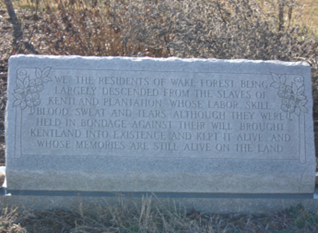
I don't know if Beth or Chelsea told you about it. Virginia Tech actually owns the area and they've done a lot of archaeology in the area they did find the cemetery and they do have a marker there currently and it says, “We the residents of Wake Forest being largely descended from the slaves of Kentland plantation whose labor skill blood sweat and tears although they were held in bondage against their will brought Kentland into existence and kept it alive and whose memories are still alive on the land,” and I just think that that gives something to the story.
Raphael
Thank you, Jessica, for sharing that beautiful statement. I’d like to thank Beth, Chelsea, and the National Mine Map Repository for sharing this cold case and being willing to have this conversation as well. For more information, visit www.osmre.gov or connect with us through any of these social media channels: Facebook, Flickr, Instagram, LinkedIn, X, Spotify and YouTube. Once again, I’m your host Raphael Evans. This has been a Bright Spot in a Dark History. Stay tuned for the next episode of Reclaim Restore and More.
Esther (VT INTERVIEW)
And I was the, as I told you, the bookkeeper – payroll person. And you know when he had his little mines... You know a lot of people that had these little mines, what they call scab mines, they just dug out coal and sold it, you know, for their own living you know. It was, it was exciting when you think about it, but it wasn't all that fun when we were doing it, but all and all it was a…a good life.